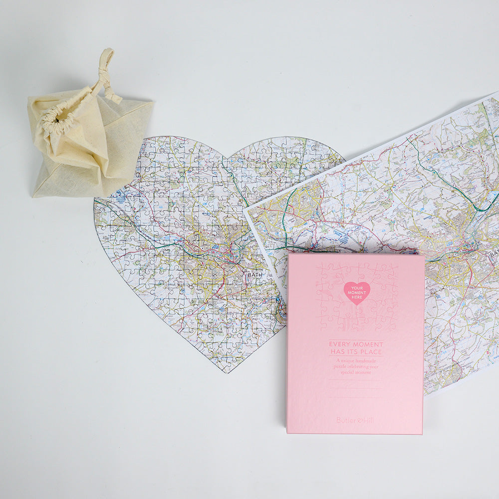
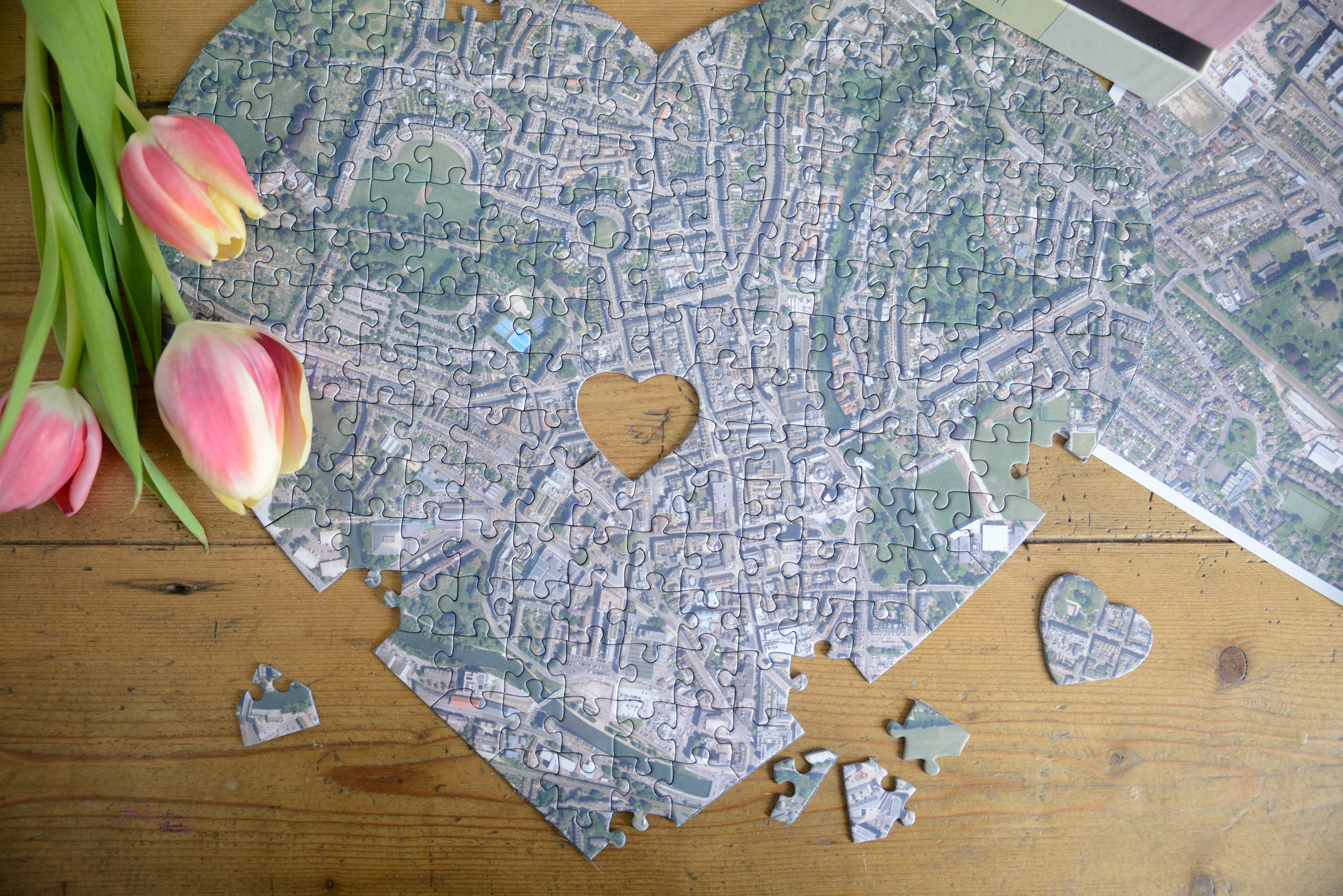
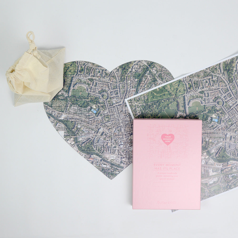
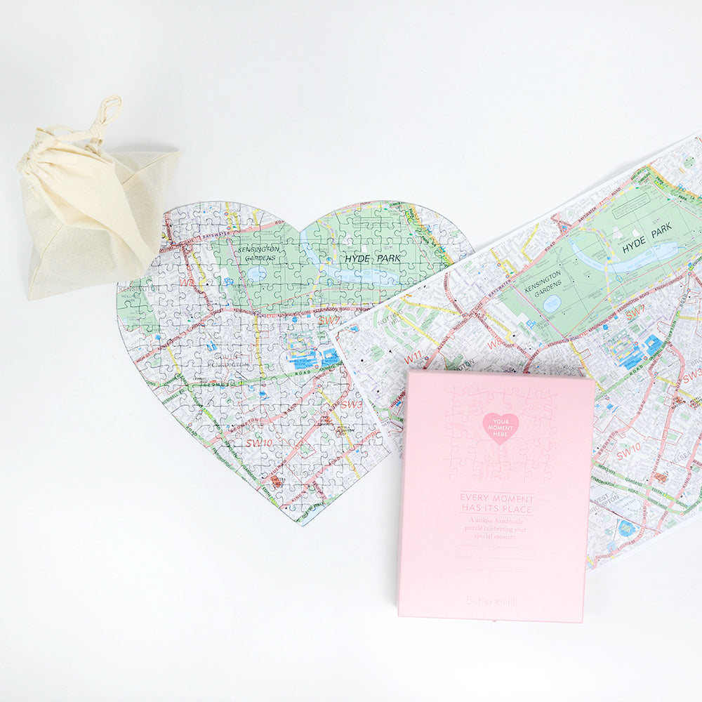
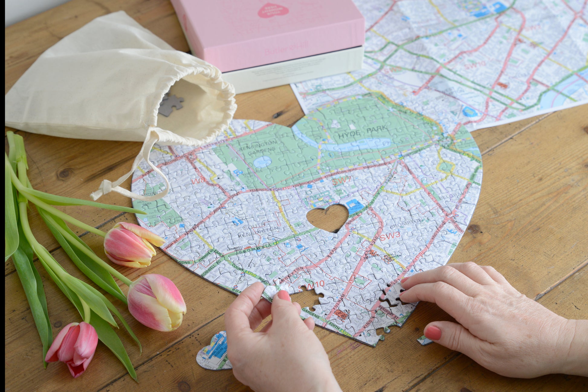
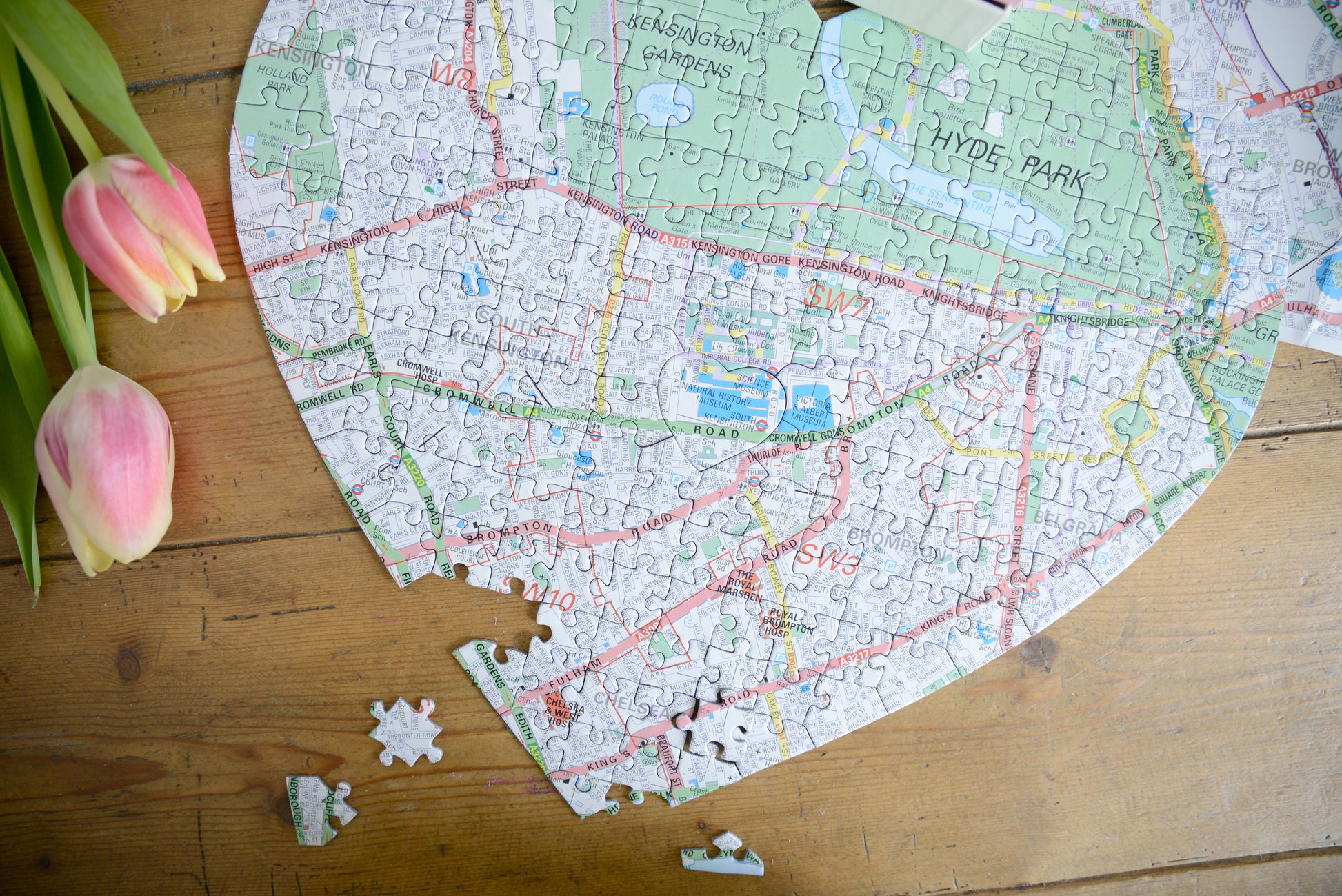
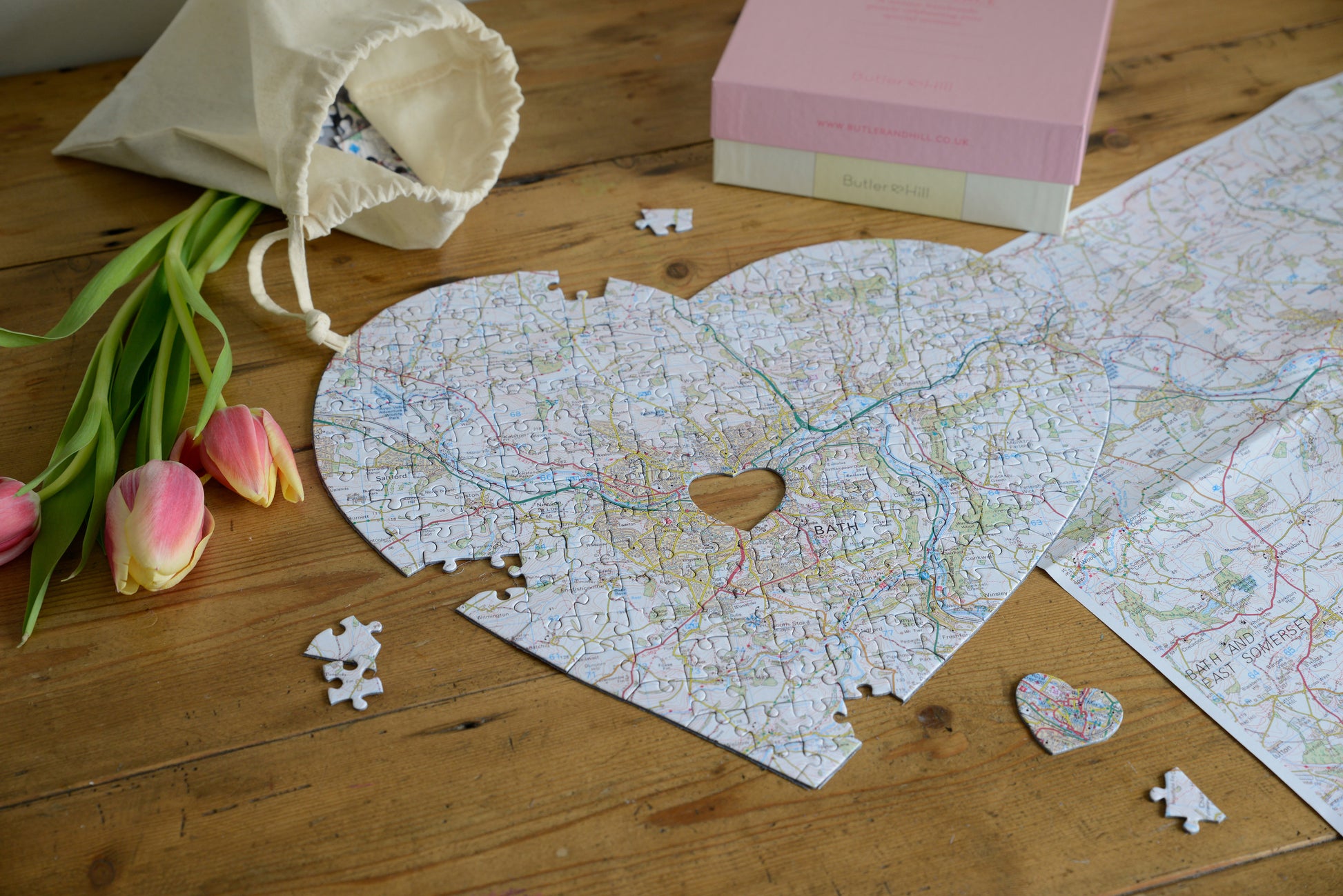
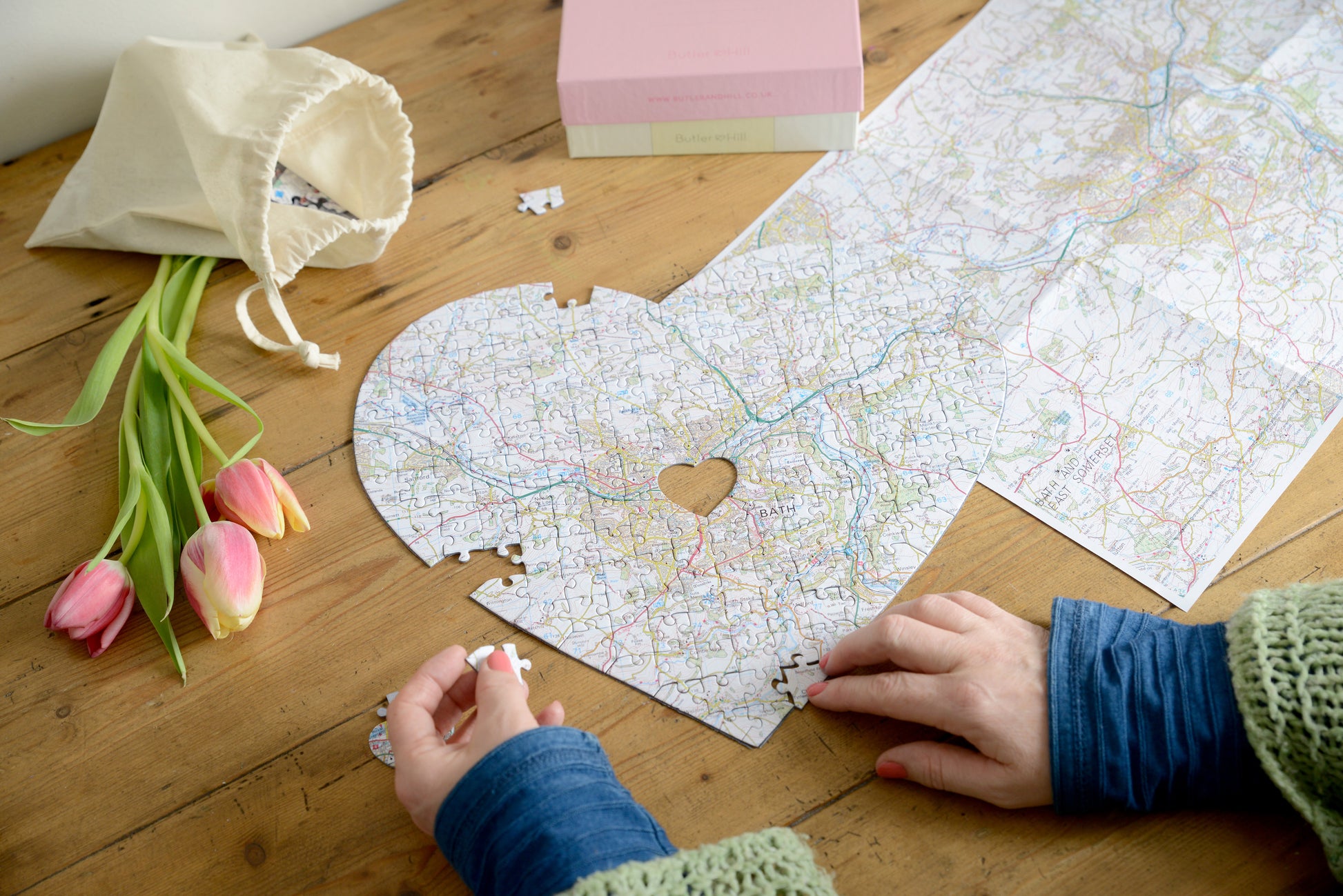
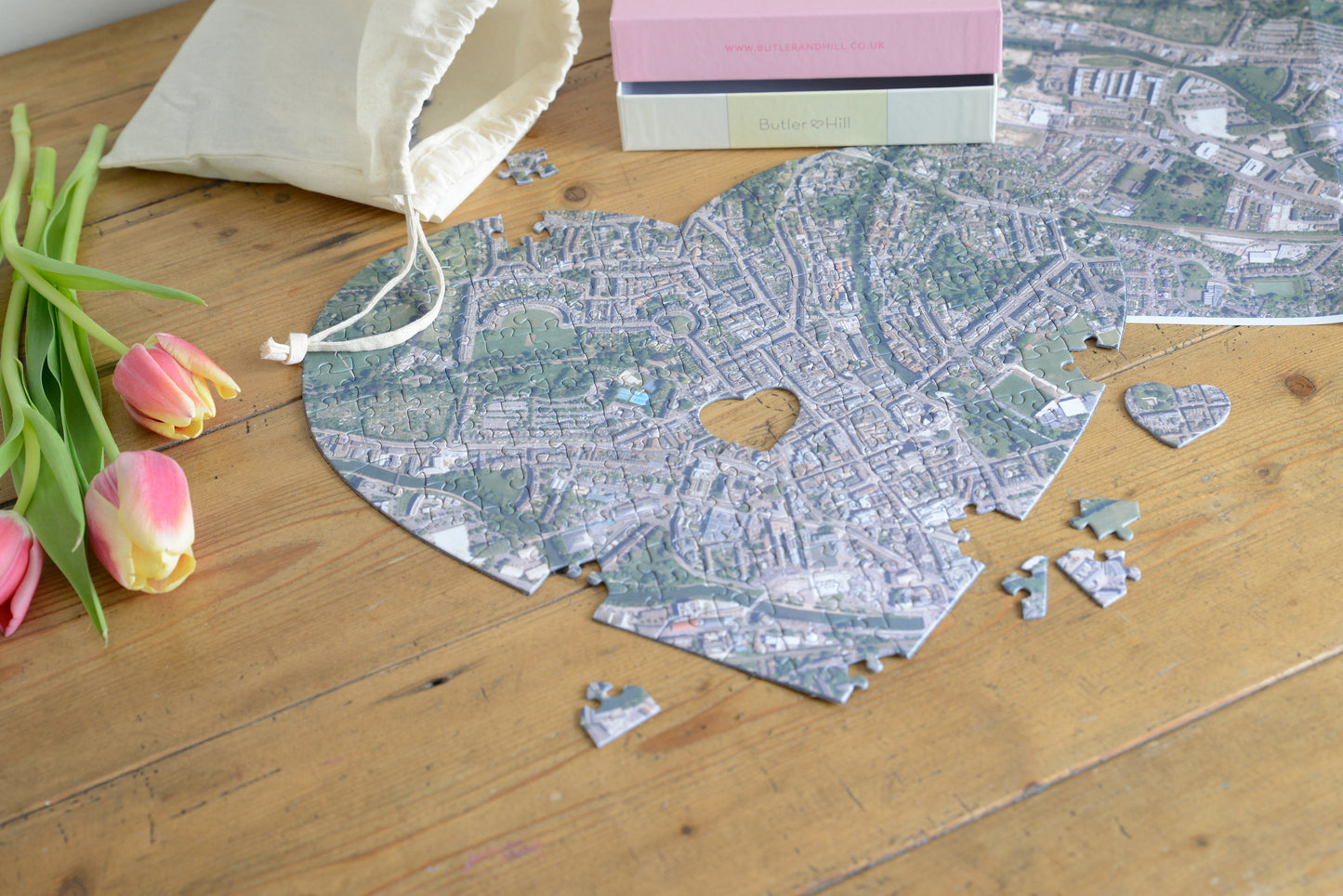
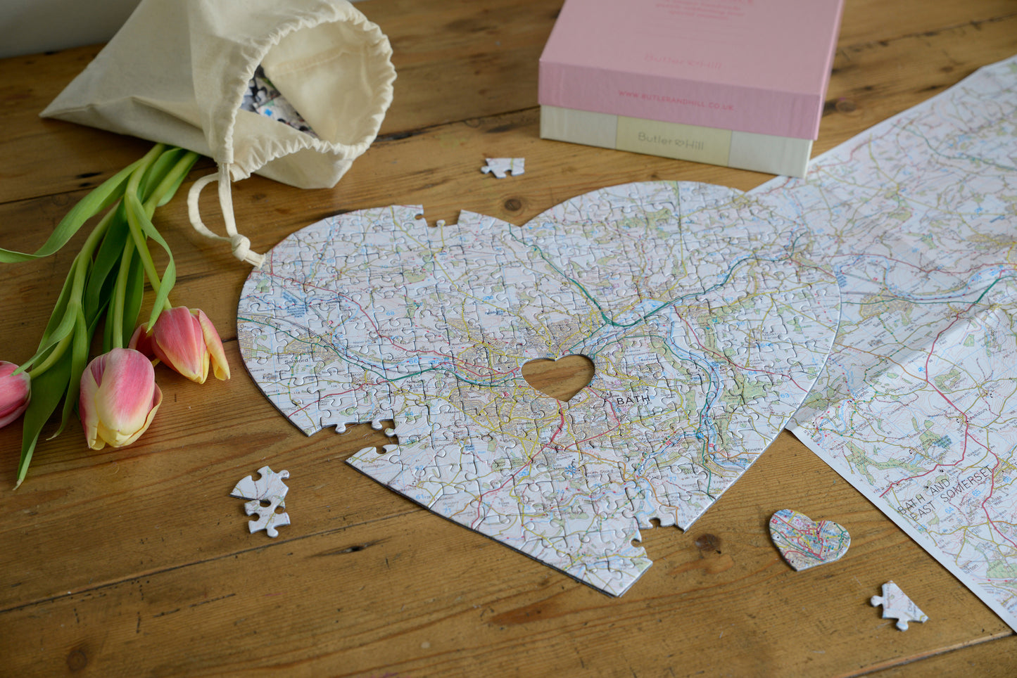
Looking for an original romantic gift for a loved one? Show your appreciation with a heart-shaped jigsaw puzzle featuring a map or aerial image with your special place in the centre. The perfect present for birthdays, anniversaries, and of course Valentine's Day.
Your chosen location could be where you first met or your favourite place to visit. Maybe it's where you got married or where you live now - the choice is entirely up to you.
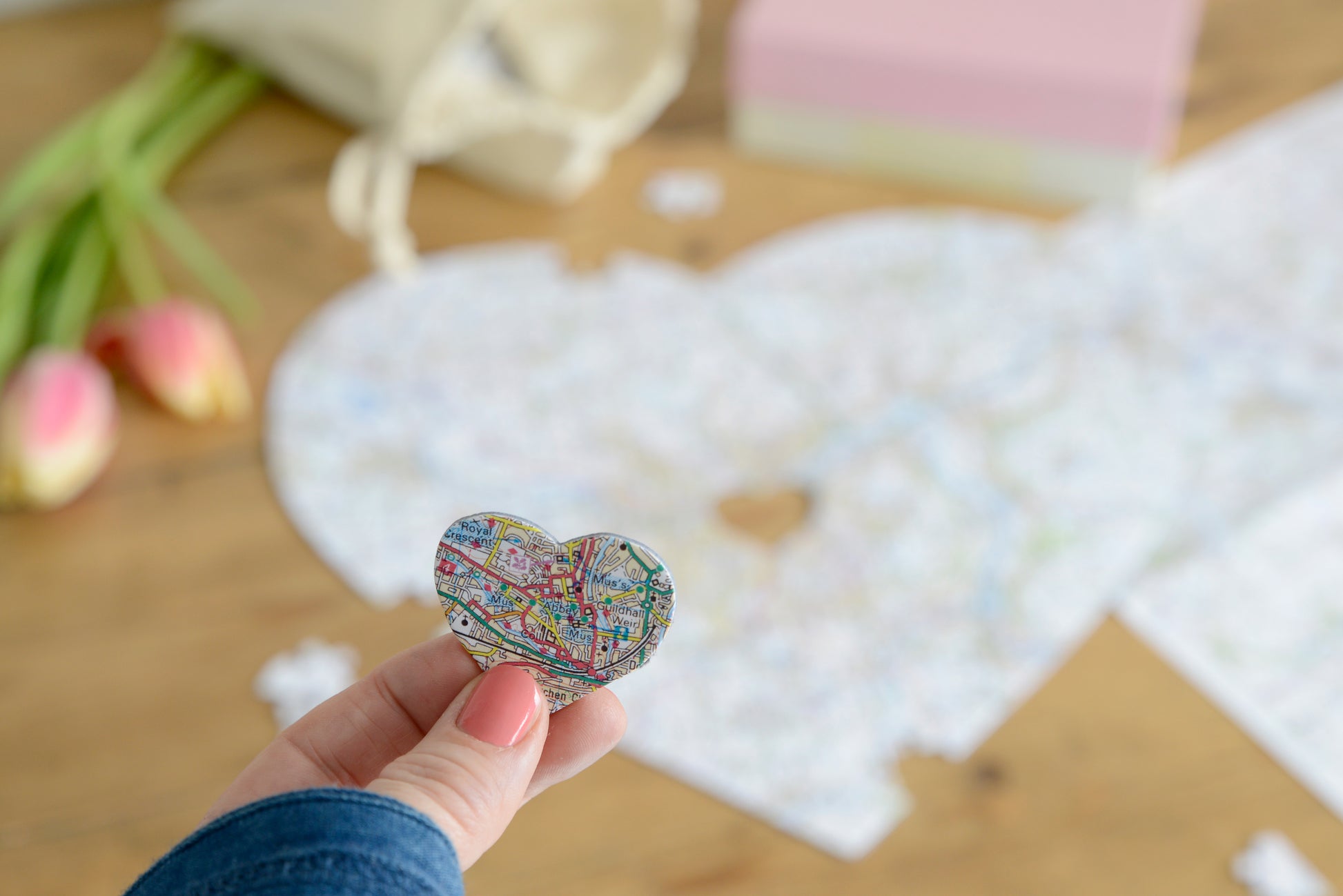
Each unique puzzle is made up of 201 pieces, with a special heart-shaped piece in the middle. Our map jigsaw puzzles are individually created based on your selected address.
Choose from the following three incredible map bases - UK Topographic, UK Aerial Photography or UK Street Mapping. See below for full details of each map.
Your made-to-order map jigsaw puzzle will have 1.9mm thick puzzle pieces, which are carefully placed in a drawstring bag within a gorgeous box made from recycled materials. A guide print is included to help you piece together your beautifully detailed map jigsaw.
This personalised product is handmade to your personal specification and will usually be delivered within 5 working days
Puzzle Size:
The completed 201 piece puzzle measures 35 x 32cm.
Mapping Base Full Details:
UK Topographic (1:50,000) -
Shows 10.87 miles East to West and 9.94 miles North to South. Covers Great Britain, the Isle of Wight, the Shetland Islands, the Orkney Islands and the Hebrides. © Crown copyright and database rights 2025 Ordnance Survey 100054682
UK Aerial Photography (1:5,000) -
Shows 1.08 miles East to West and 0.99 miles North to South. Covers England, Wales and Scotland, including the Isle of Man, Isle of Wight, the Shetland Islands, the Orkney Islands and the Hebrides. Aerial Imagery for the United Kingdom courtesy of Getmapping Ltd, 2025.
UK Street Mapping (1:14,000) -
Shows 3.04 miles North to South and 2.78 miles East to West.
Covers England and major cities in Wales and Scotland. Map Data © Crown Copyright and database rights 2025 Ordnance Survey AC0000808974.